Vat Phou and Associated Ancient Settlements within the Champasak Cultural Landscape
World Heritage
Lao People's Democratic Republic
🎧 Listen to Introduction
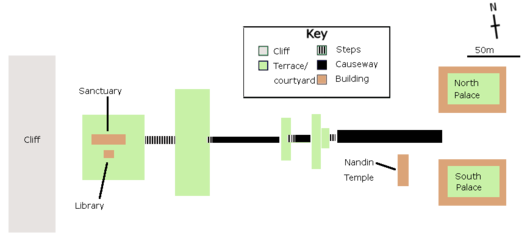
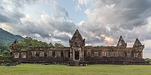
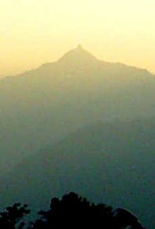
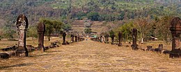
The Champasak Cultural Landscape, including the Wat Phu complex, is a well-preserved planned landscape that is more than 1,000 years old. Its shape reflects the Hindu view of the relationship between nature and humans, using an axis from the top of the mountain to the river bank to arrange the geometric patterns of temples, shrines and water conservancy facilities, stretching for about 10 kilometers. Two planned cities on the banks of the Mekong River and Phou Kao Mountain are also part of the site. The whole represents development from the 5th to the 15th century, mainly related to the Khmer Empire.
# Water conservancy facilities
# Khmer Empire
# Hinduism
# Ancient settlements
# Nature and human relationship
Poem of the heritage generated by AI
Intangible culture related to the heritage
China tourist attractions related to the heritage
World heritage related to the heritage
Show more related heritage
Information extracted from Wikidata
| image | http://commons.wikimedia.org/wiki/Special:FilePath/Wpfacade02a.jpg |
| instance of | ruins |
| instance of | wat |
| located in or next to body of water | abbaye Saint-Jean de Sorde |
| executive body | Wat Phou |
| IPA transcription | 1902364 |
| office held by head of the organization | http://g.co/kg/m/07c8ct |
| Commons category | Wat Phou |
| coordinate location | Point(105.8 14.833333) |