Schokland and Surroundings
World Heritage
Netherlands
🎧 Listen to Introduction
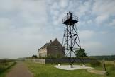
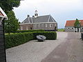
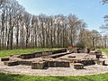
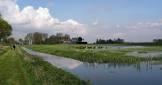
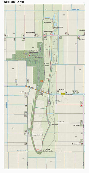
The Schokland peninsula became an island in the 15th century. Due to sea erosion, Schokland was occupied and then abandoned, and in 1859 people had to evacuate the island. But as the Zuiderzee dried up, Schokland has been part of land reclamation since the 1940s. Schokland retains traces of human habitation from prehistoric times. It symbolizes the Dutch people's heroic and long struggle against sea erosion.


Poem of the heritage generated by AI
Intangible culture related to the heritage
China tourist attractions related to the heritage
World heritage related to the heritage
Show more related heritage
Information extracted from Wikidata
| ELSTAT geographical code | schokland |
| office held by head of the organization | http://g.co/kg/m/020m72 |
| affiliation | http://bag.basisregistraties.overheid.nl/bag/id/woonplaats/1277 |
| Commons category | Schokland |
| CBS municipality code | 1369 |
| coordinate location | Point(5.771666666 52.638611111) |
| official website | https://schokland.nl/ |
| area | 1306 |
| World Heritage criteria | World Heritage selection criterion (v) |
| Amsterdam code | 11189 |
| Atlas Obscura identifier | schokland |
| image | http://commons.wikimedia.org/wiki/Special:FilePath/Schokland3.JPG |
| image | http://commons.wikimedia.org/wiki/Special:FilePath/Schokland%20luchtfoto.jpg |
| instance of | populated place in the Netherlands |
| located in the administrative territorial entity | Noordoostpolder |
| executive body | Schokland |
| publisher | Data Archiving and Networked Services |
| population | 695 |
| determination method | census |
| point in time | 1840-01-01T00:00:00Z |
| publisher | Data Archiving and Networked Services |
| population | 641 |
| determination method | census |
| point in time | 1849-01-01T00:00:00Z |
| publisher | Data Archiving and Networked Services |
| population | 676 |
| determination method | census |
| point in time | 1830-01-01T00:00:00Z |
| publisher | Data Archiving and Networked Services |
| population | 602 |
| determination method | census |
| point in time | 1815-01-01T00:00:00Z |
| start time | 1995-01-01T00:00:00Z |
| official name | شوكلاند وضواحيها |
| official name | Schokland and Surroundings |
| official name | Schokland y sus alrededores |
| official name | Schokland et ses environs |
| official name | スホクランドとその周辺 |
| official name | Schokland en omgeving |
| official name | Район Схокланд |
| official name | 斯霍克兰及其周围地区 |
| image | http://commons.wikimedia.org/wiki/Special:FilePath/Schokland4.jpg |
| media legend | The elevation of the former island is clearly visible |
| instance of | island |
| end time | 1942-01-01T00:00:00Z |
| instance of | Romagnol |
| start time | 1812-01-01T00:00:00Z |
| end time | 1859-07-10T00:00:00Z |
| replaced by | Kampen |
| end time | 1859-07-10T00:00:00Z |
| object has role | Suriname |