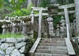
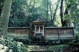
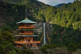
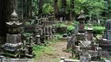
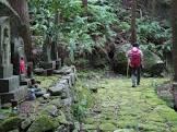
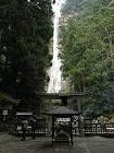
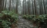
Nestled in the dense forests of the Kii Mountains overlooking the Pacific Ocean, three sacred sites—Mount Yoshino and Mount Ōmine, the Kumano Sanzan, and Mount Koya—are linked by pilgrimage routes to the ancient capitals of Nara and Kyoto and reflect a fusion of Shintoism, which grew out of Japan’s ancient tradition of nature worship, and Buddhism, which was introduced from China and the Korean peninsula. The sites (506.4 hectares) and their surrounding forested landscape reflect a well-documented sacred mountain tradition that has continued for more than 1,200 years. The area, with its many streams, rivers, and waterfalls, remains part of Japanese living culture, with up to 15 million visitors each year coming to participate in rituals and hikes. All three sites are home to shrines, some of which were established as early as the 9th century.
| office held by head of the organization |
http://g.co/kg/m/06zttn2 |
| Commons category |
Sacred sites and pilgrimage routes in the Kii mountain range |
| has part |
Kumano Nachi Taisha |
| has part |
Category:Maps of Ávila |
| has part |
Kumano Hongū Taisha |
| has part |
Pisa |
| has part |
Nachi Primeval Forest |
| has part |
Kimpusen-ji |
| has part |
Kumano Kodō |
| coordinate location |
Point(135.77639 33.83694) |
| start time |
2016-01-01T00:00:00Z |
| point in time |
2016-01-01T00:00:00Z |
| Commons gallery |
紀伊山地の霊場と参詣道 |
| area |
506.4 |
| World Heritage criteria |
Larousse Encyclopedia online |
| World Heritage criteria |
World Heritage selection criterion (vi) |
| World Heritage criteria |
World Heritage selection criterion (ii) |
| visitor centre |
Wakayama World Heritage Center |
| image |
http://commons.wikimedia.org/wiki/Special:FilePath/Daimonzaka8618.JPG |
| instance of |
reijō |
| instance of |
pilgrims' way |
| locator map image |
http://commons.wikimedia.org/wiki/Special:FilePath/LocMap%20of%20WH%20Kii%20Mountain%20Range.png |
| executive body |
Sacred sites and pilgrimage routes in the Kii mountain range |
| location of creation |
紀伊山地の霊場と参詣道 |