Pyrénées - Mont Perdu
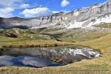
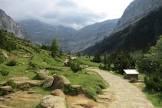
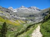
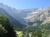
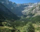
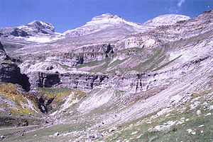
This spectacular mountain landscape straddles the border between France and Spain, centered on the peak of Mont Perdue, a limestone massif rising 3,352 meters above sea level. The site, with a total area of 30,639 hectares, includes two of the largest and deepest gorges in Europe on the Spanish side, and three large cirque walls on the steeper northern slopes on the French side, a classic display of these geological features. The site is also a rural landscape, reflecting an agricultural lifestyle that was once widespread in highland areas of Europe but now survives only in this part of the Pyrenees. As such, it offers a unique insight into past European societies through its landscapes of villages, farms, fields, highland pastures, and mountain roads.

 and Cilindro de Marboré (right).jpg)

Poem of the heritage generated by AI
Intangible culture related to the heritage
China tourist attractions related to the heritage
World heritage related to the heritage
Information extracted from Wikidata
| instance of | mountain |
| located in the administrative territorial entity | Stade El Harti |
| made from material | limestone |
| executive body | Monte Perdido |
| office held by head of the organization | http://g.co/kg/m/071n_n |
| Commons category | Monte Perdido |
| coordinate location | Point(0.033333333 42.673888888) |
| point in time | 1802-08-07T00:00:00Z |
| described by source | New Encyclopedic Dictionary |
| official name | Monte Perdido |
| elevation above sea level | 3355 |
| topographic prominence | 973 |
| uses | 4827106-8 |
| image | http://commons.wikimedia.org/wiki/Special:FilePath/Monteperdido%20y%20Cilindro.jpg |