St Kilda
World Heritage
United Kingdom of Great Britain and Northern Ireland
🎧 Listen to Introduction
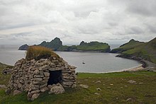
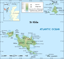
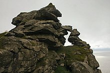
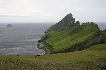
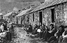
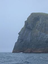
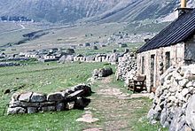
This spectacular volcanic archipelago, located off the coast of the Hebrides, consists of the islands of Hirta, Dun, Soai and Borea. It is home to Europe's highest cliffs, which are home to a large number of rare and endangered birds, especially puffins and gannets. The archipelago has not been inhabited since 1930, but the extreme climatic conditions of the Hebrides have been inhabited by humans for more than 2,000 years. The remains of human habitation include building structures and field systems, stone houses and traditional highland stone houses. These relics reflect the fragile remains of a subsistence economy based on bird products, agriculture and sheep farming.

 at left and Skaldar (Haskeir) to the north east.jpg)

.jpg)
 from the heights of Conachair.jpg)

Poem of the heritage generated by AI
Intangible culture related to the heritage
China tourist attractions related to the heritage
World heritage related to the heritage
Show more related heritage
Information extracted from Wikidata
| image | http://commons.wikimedia.org/wiki/Special:FilePath/Saint%20Kilda%2020090611%20Hirta%20-%20Village%20Bay%20overview.jpg |
| executive body | St Kilda, Scotland |
| U.S. National Archives Identifier | 10045622 |
| office held by head of the organization | http://g.co/kg/m/013rtw |
| Commons category | St Kilda, Scotland |
| located in time zone | UTC±00:00 |
| highest point | Conachair |
| coordinate location | Point(-8.5875 57.815) |
| located on terrain feature | Outer Hebrides |
| official website | http://www.kilda.org.uk |
| page banner | http://commons.wikimedia.org/wiki/Special:FilePath/St%20Kilda%20Scotland%20banner%20View%20from%20Berneray.JPG |
| U.S. National Archives Identifier | 10045622 |
| start time | 1986-01-01T00:00:00Z |
| native label | St Kilda |
| elevation above sea level | 430 |
| area | 8.546 |
| World Heritage criteria | World Heritage selection criterion (x) |
| World Heritage criteria | World Heritage selection criterion (v) |
| named as | St Kilda, Inverness Shire |
| located in the administrative territorial entity | Outer Hebrides |
| object has role | Jefferson County |
| located in the administrative territorial entity | Harris |
| object has role | Scottish civil parish |
| point in time | 2004-01-01T00:00:00Z |
| series ordinal | 1 |
| point in time | 2005-01-01T00:00:00Z |
| series ordinal | 2 |
| population | 0 |
| point in time | 2012-01-01T00:00:00Z |
| described by source | The Nuttall Encyclopædia |
| stated as | Kilda, St. |
| named as | St Kilda |
| subject has role | island |