Rideau Canal
World Heritage
Canada
🎧 Listen to Introduction
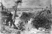
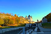
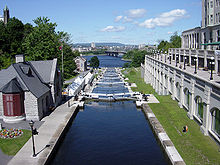
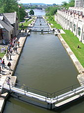
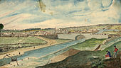
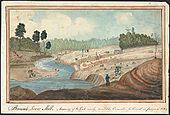
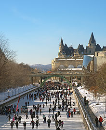
The Rideau Canal is a magnificent construction of the early 19th century, covering the Rideau and Cataraqui Rivers, stretching 202 kilometers from Ottawa south to the port of Kingston on Lake Ontario. It was built primarily for strategic military purposes, as Britain and the United States competed for control of the region. The canal was one of the first canals designed for steam-powered ships and also featured a series of fortifications. It is the best-preserved still-water canal in North America, demonstrating the large-scale application of this European technology. It is the only canal from the early 19th century North American canal-building era to remain on its original route, with much of its structure intact.
# 19th century
# Fortifications
# Strategic Military
# Steam powered ships
# North America
# Stillwater Canal


Poem of the heritage generated by AI
Intangible culture related to the heritage
China tourist attractions related to the heritage
World heritage related to the heritage
Show more related heritage
Information extracted from Wikidata
| number of rooms | viaf-316742390 |
| office held by head of the organization | http://g.co/kg/m/01dl07 |
| part of | Category:People from Rio de Janeiro (city) |
| Commons category | Rideau Canal |
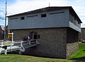
| has part | Ottawa Locks |
| has part | Tay Canal |
| coordinate location | Point(-75.698055 45.426389) |
| language of work or name | English |
| topic's main category | multi-purpose hall |
| page banner | http://commons.wikimedia.org/wiki/Special:FilePath/WV%20banner%20Ottawa-Rideau%20Rideau%20canal.jpg |
| start time | 1925-05-15T00:00:00Z |
| length | 202 |
| area | 21427.07 |
| topographic isolation | 503 |
| territory overlaps | Peglio |
| drainage basin | Ottawa River drainage basin |
| country | Canada |
| image | http://commons.wikimedia.org/wiki/Special:FilePath/Rideau%20Canal.jpg |
| executive body | Rideau Canal |
| ISIN | FEZXH |
| ISIN | FEZXI |
| instance of | right bank |
| coordinate location | Point(-75.697222222 45.425833333) |
| located in the administrative territorial entity | Kingston |
| coordinate location | Point(-76.475144444 44.219830555) |
| heritage designation | Category:Views of Pienza |
| start time | 2007-01-01T00:00:00Z |
| official name | Rideau Canal |
| area | 2334.78 |
| applies to part | buffer zone |