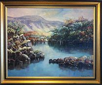
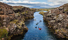
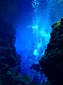
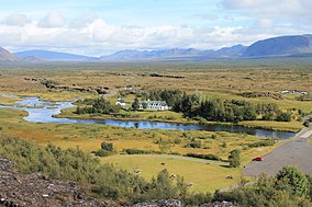
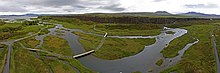
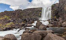
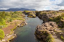
Thingvellir National Park is a national park and the site of the Icelandic Parliament (Althing), an open-air parliament representing the entire Icelandic people, which was established in 930 and lasted until 1798. For two weeks each year, the Parliament made laws (which were seen as contracts between free men) and resolved disputes. The Parliament has a deep historical and symbolic meaning for the Icelandic people. The heritage site includes the remains of Thingvellir National Park and the Parliament itself: fragments of about 50 stalls built of turf and stone. Remains from the 10th century are believed to be buried in the ground. The site also includes remains of agricultural use from the 18th and 19th centuries. The park shows how the land was cultivated for over 1,000 years.
| office held by head of the organization |
http://g.co/kg/m/0319z2 |
| Commons category |
Þingvellir |
| located in time zone |
UTC±00:00 |
| inception |
1928-01-01T00:00:00Z |
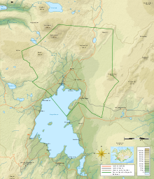
| coordinate location |
Point(-21.125 64.258055555) |
| official website |
http://www.thingvellir.is/english/ |
| Commons gallery |
Þingvellir |
| page banner |
http://commons.wikimedia.org/wiki/Special:FilePath/Thingvellir%20Banner.jpg |
| population |
0 |
| start time |
2004-01-01T00:00:00Z |
| elevation above sea level |
120 |
| area |
237 |
| World Heritage criteria |
World Heritage selection criterion (vi) |
| Wolfram Language entity code |
Entity["Park", "ThingvellirNationalPark::n32d3"] |
| object has role |
Eliza Fraser |
| Atlas Obscura identifier |
thingvellir |
| category for maps |
Category:Maps of Þingvellir |
| category for the view from the item |
Category:Views from Þingvellir |
| category for the view of the item |
Category:Views of Þingvellir |
| uses |
4339356-1 |
| image |
http://commons.wikimedia.org/wiki/Special:FilePath/Thingvellir.jpg |
| instance of |
Old Town of Lijiang |
| located in or next to body of water |
River Thames |
| executive body |
Þingvellir |
| location of creation |
Þingvellir |
| Wolfram Language entity code |
Entity["Park", "ThingvellirNationalPark::n32d3"] |
| ELSTAT geographical code |
thingvellir |