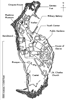
Island of Gorée
World Heritage
Senegal
🎧 Listen to Introduction
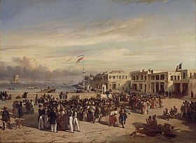
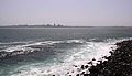
Gorée Island is located off the coast of Senegal, across the sea from Dakar. From the 15th to the 19th century, it was the largest slave trading center on the African coast. The island was ruled by Portugal, the Netherlands, Britain and France, and its architecture is characterized by the contrast between the gloomy slave quarters and the elegant houses of the slave traders. Today, it remains a relic of human exploitation and a refuge for reconciliation.


.jpg)
, Musée de la Compagnie .jpg)
 and Orange (1639). Coloured engraving, Holland, 17t.jpg)


Poem of the heritage generated by AI
Intangible culture related to the heritage
China tourist attractions related to the heritage
World heritage related to the heritage
Show more related heritage
Information extracted from Wikidata
| heritage designation | Davos Wiesen railway station |
| native label | Île de Gorée |
| area | 0.182 |
| perimeter | 3 |
| World Heritage criteria | World Heritage selection criterion (vi) |
| on focus list of Wikimedia project | WikiProject African diaspora |
| Atlas Obscura identifier | goree-island |
| country | Senegal |
| instance of | urban area |
| instance of | island |
| located in the administrative territorial entity | Plateau/Gorée Arrondissement |
| locator map image | http://commons.wikimedia.org/wiki/Special:FilePath/Dakar%20Gor%C3%A9e.svg |
| executive body | Gorée |
| location of creation | Île de Gorée |
| U.S. National Archives Identifier | 10046232 |
| IPA transcription | 2370326 |
| ELSTAT geographical code | goree-island |
| number of rooms | lccn-n83303519 |
| office held by head of the organization | http://g.co/kg/m/04mn6q |
| Commons category | Gorée |
| located in time zone | UTC±00:00 |
| coordinate location | Point(-17.398333333 14.666944444) |
| named as | Gorée (Senegal : ostrov) |
| topic's main category | Category:Gorée |
| Commons gallery | Île de Gorée |
| page banner | http://commons.wikimedia.org/wiki/Special:FilePath/%C3%8Ele%20de%20Gor%C3%A9e%20vue%20du%20large%20pagebanner.jpg |
| population | 1680 |
| U.S. National Archives Identifier | 10046232 |
| start time | 1978-01-01T00:00:00Z |
| official name | جزيرة غوري |
| official name | Insel Gorée |
| official name | Island of Gorée |
| official name | Isla de Gorea |
| official name | Île de Gorée |
| official name | ゴレ島 |
| official name | Eiland van Gorée |
| official name | Остров Горе |
| official name | 戈雷岛 |
| volume as quantity | World Heritage selection criterion (vi) |
| image | http://commons.wikimedia.org/wiki/Special:FilePath/Senegal%20Gor%C3%A9e%20island%20harbor.jpg |
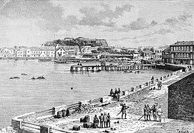
| media legend | Port de l'illa de Gorée |