Historic Centres of Stralsund and Wismar
World Heritage
Germany
🎧 Listen to Introduction
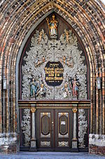
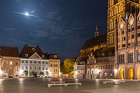
The two medieval towns of Wismar and Stralsund, located on the Baltic coast in northern Germany, were major trading centres of the Hanseatic League in the 14th and 15th centuries. In the 17th and 18th centuries, they became administrative and defence centres for Swedish territories in Germany. They contributed to the development of Brick Gothic architectural types and techniques in the Baltic region, as evidenced by several important brick cathedrals, Stralsund Town Hall and a range of houses for residential, commercial and craft purposes, representing its evolution over the centuries.


Poem of the heritage generated by AI
Intangible culture related to the heritage
China tourist attractions related to the heritage
World heritage related to the heritage
Show more related heritage
Information extracted from Wikidata
| category for people who died here | Category:Deaths in Stralsund |
| category of associated people | Category:People from Stralsund |
| elevation above sea level | 9 |
| area | 38970000 |
| Image Archive, Herder Institute | Q4065 |
| location of creation | Stralsund |
| WOEID | 697654 |
| number of rooms | lccn-n50027114 |
| office held by head of the organization | http://g.co/kg/m/0r_w6 |
| postal code | 18439 |
| postal code | 18437 |
| postal code | 18435 |
| Commons category | Stralsund |
| German municipality key | 13073088 |
| member of | Základní Škola Vachkova |
| start time | 2009-01-01T00:00:00Z |
| start time | 2018-12-01T00:00:00Z |
| local dialing code | 03831 |
| inception | 1234-01-01T00:00:00Z |
| coordinate location | Point(13.081944444 54.309166666) |
| significant event | Siege of Stralsund |
| significant event | Kremlin and Red Square |
| significant event | Siege of Stralsund, 1807 |
| official website | http://www.stralsund.de |
| topic's main category | Category:Stralsund |
| Commons gallery | Stralsund |
| page banner | http://commons.wikimedia.org/wiki/Special:FilePath/Stralsund%20banner.jpg |
| Dewey Decimal Classification | 2--431786 |
| WOEID | 697654 |
| uses | 4057860-4 |
| country | Germany |
| image | http://commons.wikimedia.org/wiki/Special:FilePath/20-07-06-Stralsund-Innenstadt-RalfR-100-0613.jpg |
| flag image | http://commons.wikimedia.org/wiki/Special:FilePath/Flag%20of%20Stralsund.svg |
| coat of arms image | http://commons.wikimedia.org/wiki/Special:FilePath/DEU%20Stralsund%20COA.svg |
| start time | 2011-01-01T00:00:00Z |
| twinned administrative body | Tanglin |
| start time | 1991-01-01T00:00:00Z |
| twinned administrative body | Svendborg |
| start time | 1987-09-17T00:00:00Z |
| locator map image | http://commons.wikimedia.org/wiki/Special:FilePath/Stralsund%20in%20VR.svg |
| executive body | Stralsund |
| instance of | location identifier |
| short name | Sra |
| area | 54.14 |
| point in time | 2017-12-31T00:00:00Z |
| licence plate code | A |
| start time | 1952-01-01T00:00:00Z |
| end time | 1990-01-01T00:00:00Z |
| licence plate code | HST |
| start time | 1990-01-01T00:00:00Z |
| NUTS code | DE805 |
| start time | 1995-01-01T00:00:00Z |
| end time | 2014-12-31T00:00:00Z |
| population | 58041 |
| point in time | 2015-12-31T00:00:00Z |
| population | 59421 |
| determination method | statistical updating |
| point in time | 2019-09-30T00:00:00Z |
| population | 57525 |
| point in time | 2014-12-31T00:00:00Z |
| population | 59517 |
| point in time | 2017-12-31T00:00:00Z |
| population | 59421 |
| point in time | 2018-12-31T00:00:00Z |
| start time | 1952-01-01T00:00:00Z |
| end time | 1990-01-01T00:00:00Z |
| start time | 1945-01-01T00:00:00Z |
| end time | 1952-01-01T00:00:00Z |