Historic Centre of Oaxaca and Archaeological Site of Monte Albán
World Heritage
Mexico
🎧 Listen to Introduction
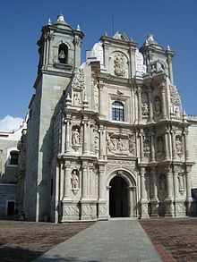
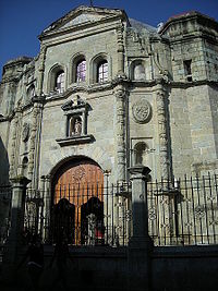
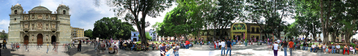
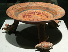
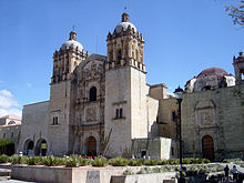
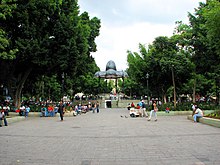
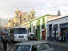
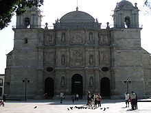
Inhabited for 1,500 years by a variety of peoples, including the Olmecs, Zapotecs and Mixtecs, Monte Alban’s terraces, dams, canals, pyramids and artificial mounds were carved out of the mountain as a symbol of sacred topography. The nearby city of Oaxaca, laid out on a grid, is a prime example of town planning during the Spanish colonial period. The solidity and volume of the city’s buildings suggest they were adapted to the earthquake-prone region where these architectural gems were built.
# Town Planning
# Monte Alban Archaeological Site
# Olmec
# Zapotec
# Mixtec
# Spanish colonial period


Poem of the heritage generated by AI
Intangible culture related to the heritage
China tourist attractions related to the heritage
World heritage related to the heritage
Show more related heritage
Information extracted from Wikidata
| uses | 4304252-1 |
| head of government | José Antonio Hernández Fraguas |
| country | Mexico |
| located in the administrative territorial entity | Oaxaca de Juárez Municipality |
| seal image | http://commons.wikimedia.org/wiki/Special:FilePath/Esc%20Municipal%20Oaxaca%20de%20Juarez.svg |
| twinned administrative body | Santa Cruz |
| twinned administrative body | Community of Vallagarina |
| twinned administrative body | Morelia |
| twinned administrative body | General Escobedo |
| twinned administrative body | Arequipa |
| twinned administrative body | Rayón Municipality |
| twinned administrative body | Tuxtla Gutiérrez |
| locator map image | http://commons.wikimedia.org/wiki/Special:FilePath/Mexico%20Oaxaca%20Oaxaca%20location%20map.svg |
| executive body | Oaxaca de Juárez |
| U.S. National Archives Identifier | 10045238 |
| official language | Oaxaca de Juárez Municipality |
| male population | 1217089 |
| IPA transcription | 2281999 |
| number of rooms | lccn-n81144155 |
| office held by head of the organization | http://g.co/kg/m/01bl0v |
| postal code | 68000 |
| Commons category | Oaxaca de Juárez |
| located in time zone | UTC−06:00 |
| local dialing code | 951 |
| inception | 1486-01-01T00:00:00Z |
| coordinate location | Point(-96.75 17.083333333) |
| named as | Oaxaca de Juárez (Mexiko) |
| official website | http://www.municipiodeoaxaca.gob.mx |
| topic's main category | Category:Oaxaca de Juárez |
| page banner | http://commons.wikimedia.org/wiki/Special:FilePath/Oaxaca%20banner%20Guelaguetza.jpg |
| Dewey Decimal Classification | 2--7274 |
| U.S. National Archives Identifier | 10045238 |
| described by source | New Encyclopedic Dictionary |
| statement is subject of | Category:Maps of Budapest |
| capital of | Oaxaca de Juárez Municipality |
| category for people who died here | Skara Brae |
| category of associated people | Category:People from Oaxaca City |
| elevation above sea level | 1557 |
| elevation above sea level | 1555 |
| area | 85.47 |
| image | http://commons.wikimedia.org/wiki/Special:FilePath/Oaxaca%20centro.jpg |
| media legend | Ti kalsada iti puseg ti ili ti Oaxaca de Juárez |
| twinned administrative body | Palo Alto |
| start time | 1964-01-01T00:00:00Z |
| twinned administrative body | Cancun |
| start time | 1993-12-01T00:00:00Z |
| population | 300050 |
| point in time | 2014-01-01T00:00:00Z |
| official name | Antequera |
| end time | 1821-01-01T00:00:00Z |
| official name | Oaxaca |
| start time | 1821-01-01T00:00:00Z |