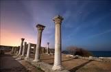
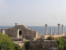
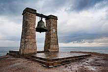
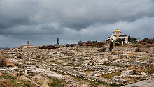
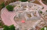
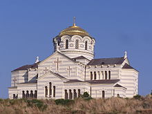
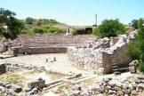
The site is the remains of a city founded by the Dorian Greeks on the northern shore of the Black Sea in the 5th century BC. It includes six component sites, including urban remains and agricultural fields, divided into hundreds of rectangular plots of equal size. These plots supported vineyards, the output of which was exported by the city, which flourished until the 15th century. The site features several public building complexes and residential areas, as well as early Christian monuments, remains of Stone Age and Bronze Age settlements, Roman and Medieval tower fortifications and water supply systems, and well-preserved vineyard plantings and partition walls. In the 3rd century AD, the site was known as the most productive wine center on the Black Sea and remained a hub for communication between the Greek, Roman and Byzantine empires and populations north of the Black Sea. It is an outstanding example of democratic land organization associated with ancient city-states, reflecting the social organization of the city.
| country |
Russia |
| object has role |
de facto |
| image |
http://commons.wikimedia.org/wiki/Special:FilePath/Chersonesos%20ruins.jpg |
| media legend |
Руины Херсонеса |
| described by source |
Paulys Realenzyklopädie der klassischen Altertumswissenschaft |
| statement is subject of |
Chersonesos 20 (Pauly-Wissowa) |
| heritage designation |
Category:Views of Pienza |
| start time |
2013-01-01T00:00:00Z |
| official name |
Ancient City of Tauric Chersonese and its Chora |